
Tapéus topographic map
Interactive map
Click on the map to display elevation.
About this map
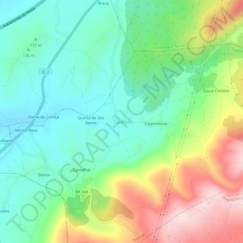
Name: Tapéus topographic map, elevation, terrain.
Location: Tapéus, Soure, Coímbra, Portugal (40.01672 -8.55993 40.05672 -8.51993)
Average elevation: 185 m
Minimum elevation: 48 m
Maximum elevation: 446 m
Other topographic maps
Click on a map to view its topography, its elevation and its terrain.