
Bezirk Zell am See topographic map
Interactive map
Click on the map to display elevation.
About this map
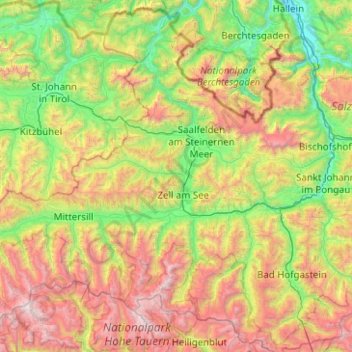
Name: Bezirk Zell am See topographic map, elevation, terrain.
Location: Bezirk Zell am See, Salzburg, Austria (47.03561 12.07610 47.68269 13.07622)
Average elevation: 1,506 m
Minimum elevation: 443 m
Maximum elevation: 3,672 m
Other topographic maps
Click on a map to view its topography, its elevation and its terrain.