Geolocate

Baraka topographic map

Click on the map to display elevation.

About this map

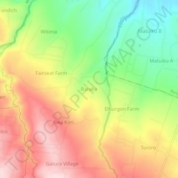
Name: Baraka topographic map, elevation, terrain.

Location: Baraka, Elburgon ward, Molo, Nakuru, Rift Valley, Kenya (-0.26766 35.78155 -0.22766 35.82155)

Average elevation: 2,215 m

Minimum elevation: 2,047 m

Maximum elevation: 2,379 m

Gear up for your next adventure:

Outdoor Coffee Makers - Enjoy quality coffee at the summit of your favorite peak
Ultralight Solo Tents - Compact shelters for multi-day topographic surveying expeditions
📡Portable Emergency Radios - Stay informed about weather warnings and bushfire alerts
🧥Softshell Jackets - Flexible outdoor jackets
🛠️Outdoor Repair Kits - Gear repair kits

As an Amazon Associate, this site earns from qualifying purchases at no extra cost to you.