Geolocate

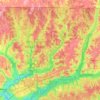
Munson topographic map

Click on the map to display elevation.

About this map

Name: Munson topographic map, elevation, terrain.

Location: Munson, Santa Rosa County, Florida, United States (30.83769 -86.89302 30.87769 -86.85302)

Average elevation: 50 m

Minimum elevation: 22 m

Maximum elevation: 79 m

Other topographic maps

Click on a map to view its topography, its elevation and its terrain.
Milton

United States > Florida > Santa Rosa County

Average elevation: 15 m

Pace

United States > Florida > Santa Rosa County > Pace

Average elevation: 17 m

Jay

United States > Florida > Santa Rosa County

Average elevation: 79 m

Milton

United States > Florida > Santa Rosa County

Average elevation: 15 m

Pace

United States > Florida > Santa Rosa County > Pace

Average elevation: 17 m

Pace

United States > Florida > Santa Rosa County > Pace

Average elevation: 17 m

Bagdad

United States > Florida > Santa Rosa County

Average elevation: 10 m

Pace

United States > Florida > Santa Rosa County > Pace

Average elevation: 17 m

Jay

United States > Florida > Santa Rosa County

Average elevation: 79 m

Jay

United States > Florida > Santa Rosa County

Average elevation: 79 m

Gear up for your next adventure:

🪢550 Survival Paracord - Versatile cordage for gear repair and emergency lashing
🎧Bluetooth Outdoor Earbuds - Listen to navigation cues or podcasts during long solo treks
🧴SPF 50+ Bulk Sunscreen - Maximum protection for long-term outdoor exposure
🧭Military Style Lensatic Compass - Durable sighting compasses for advanced land navigation and surveying
🧼Biodegradable Outdoor Soap - Clean gear and yourself without harming the local ecosystem

As an Amazon Associate, this site earns from qualifying purchases at no extra cost to you.