Geolocate

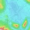
Kienberg topographic map

Click on the map to display elevation.

About this map

Name: Kienberg topographic map, elevation, terrain.

Location: Kienberg, Obing (VGem), Landkreis Traunstein, Bavaria, 83361, Germany (48.01355 12.41707 48.06641 12.51811)

Average elevation: 549 m

Minimum elevation: 497 m

Maximum elevation: 604 m

Other topographic maps

Click on a map to view its topography, its elevation and its terrain.

Tinning

Germany > Bavaria > Landkreis Traunstein

Average elevation: 519 m

Niederachen

Germany > Bavaria > Landkreis Traunstein > Eck

Average elevation: 768 m

Waginger See

Germany > Bavaria > Landkreis Traunstein > Waginger See > Fisching

Waginger See is a lake in the Alpine foothills, Bavaria, Germany. Geologically, it forms one single lake with the Tachinger See, with which it is connected through a narrow strait at Tettenhausen. The surface area of the Waginger See proper is 6.61 km2 (2.55 sq mi); combined with the Tachinger See it is 8.97…

Average elevation: 464 m
Gilling

Germany > Bavaria > Landkreis Traunstein > Petting

Average elevation: 477 m

Hochwies

Germany > Bavaria > Landkreis Traunstein > Trostberg

Average elevation: 528 m

Ollerding

Germany > Bavaria > Landkreis Traunstein > Tittmoning

Average elevation: 487 m

Burgham

Germany > Bavaria > Landkreis Traunstein > Seeon-Seebruck

Average elevation: 525 m

Schönberg

Germany > Bavaria > Landkreis Traunstein > Kienberg

Average elevation: 538 m

Gear up for your next adventure:

🧤Hiking Gloves - Protective gloves for outdoor use
👟Lightweight Trail Runners - Agile footwear for fast movement over rugged Australian terrain
📚Map Reading & Navigation Guides - Master the art of interpreting topographic contours and symbols
🧴SPF 50+ Bulk Sunscreen - Maximum protection for long-term outdoor exposure
🧦Merino Wool Hiking Socks - Moisture-wicking socks to prevent blisters during long topographic surveys

As an Amazon Associate, this site earns from qualifying purchases at no extra cost to you.