Geolocate

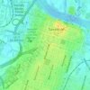
Coffee Bluff topographic map

Click on the map to display elevation.

About this map

Name: Coffee Bluff topographic map, elevation, terrain.

Location: Coffee Bluff, Savannah, Chatham County, Georgia, 31419, United States (31.91688 -81.17316 31.95688 -81.13316)

Average elevation: 3 m

Minimum elevation: -6 m

Maximum elevation: 18 m

Other topographic maps

Click on a map to view its topography, its elevation and its terrain.

Gear up for your next adventure:

🖼️Scratch-off Australia Map - Track the regions and peaks you have explored geographically
🔪Multitools - Compact tools for outdoor use
📟Satellite Messengers - Two-way satellite communication to stay in touch beyond the cellular grid
🧊Insulated Stainless Steel Flasks - Keep water cold for 24 hours in the heat or coffee hot in the cold
🧣Merino Neck Gaiters - Versatile headwear for warmth, sun protection, or dust filtering

As an Amazon Associate, this site earns from qualifying purchases at no extra cost to you.