
Thank you for supporting this site ❤️
Make a donation
Make a donation
Gear up for your next adventure:
As an Amazon Associate, this site earns from qualifying purchases at no extra cost to you.
Jikaze topographic map
Click on the map to display elevation.
Thank you for supporting this site ❤️
Make a donation
Make a donation
Gear up for your next adventure:
As an Amazon Associate, this site earns from qualifying purchases at no extra cost to you.
About this map
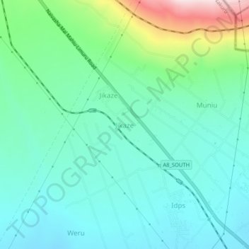
Name: Jikaze topographic map, elevation, terrain.
Location: Jikaze, Mai Mahiu ward, Naivasha, Nakuru, Rift Valley, Kenya (-0.95901 36.51756 -0.91901 36.55756)
Average elevation: 1,971 m
Minimum elevation: 1,866 m
Maximum elevation: 2,317 m
Thank you for supporting this site ❤️
Make a donation
Make a donation
Gear up for your next adventure:
As an Amazon Associate, this site earns from qualifying purchases at no extra cost to you.