
Cape Coral topographic map
Interactive map
Click on the map to display elevation.
About this map
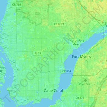
Name: Cape Coral topographic map, elevation, terrain.
Location: Cape Coral, Lee County, Floride, États-Unis d'Amérique (26.52513 -82.09166 26.77003 -81.90031)
Average elevation: 4 m
Minimum elevation: -1 m
Maximum elevation: 12 m
Other topographic maps
Click on a map to view its topography, its elevation and its terrain.
Koreshan Preserve
États-Unis d'Amérique > Floride > Lee County > Estero
Koreshan Preserve, Estero, Lee County, Floride, États-Unis d'Amérique
Average elevation: 6 m
Bonita Springs
États-Unis d'Amérique > Floride > Lee County > Pelican Landing
Bonita Springs, Pelican Landing, Lee County, Floride, 34136, États-Unis d'Amérique
Average elevation: 5 m
Fort Myers Beach
États-Unis d'Amérique > Floride > Lee County
Fort Myers Beach, Lee County, Floride, 33931, États-Unis d'Amérique
Average elevation: 1 m