Geolocate

Mandalay topographic map

Interactive map

Click on the map to display elevation.

About this map

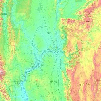
Name: Mandalay topographic map, elevation, terrain.

Location: Mandalay, Myanmar (20.19307 94.82973 23.68381 96.89598)

Average elevation: 505 m

Minimum elevation: 36 m

Maximum elevation: 3,012 m

Other topographic maps

Click on a map to view its topography, its elevation and its terrain.

Daw

Myanmar > Tanintharyi Region > Myeik Township > Se Ein Su

Average elevation: 28 m

Bogale

Myanmar > Ayeyarwady > Bogale

Average elevation: 4 m

Nay Pyi Taw

Myanmar > Naypyitaw Union Territory

Average elevation: 133 m

Yangon

Myanmar > Yangon > Yangon

Average elevation: 6 m

Yangon

Myanmar

Average elevation: 158 m

Inn

Myanmar > Sagaing > Inn

Average elevation: 90 m