Geolocate

Wellingborough topographic map

Click on the map to display elevation.

About this map
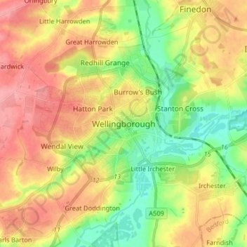
Name: Wellingborough topographic map, elevation, terrain.

Location: Wellingborough, North Northamptonshire, England, NN8 1AF, United Kingdom (52.26189 -0.73373 52.34189 -0.65373)

Average elevation: 76 m

Minimum elevation: 33 m

Maximum elevation: 120 m

Other topographic maps

Click on a map to view its topography, its elevation and its terrain.

Gear up for your next adventure:

🧺Fast-Dry Microfiber Towels - Large towels that pack down to the size of an orange
🎒40L Day Hiking Backpacks - Comfortable packs with hydration support for long days exploring topographic peaks
🧦Hiking Socks - Comfortable socks for long hikes
🍳Camping Cookware - Cookware sets for outdoor meals
🛌Sleeping Bags - Sleeping bags for outdoor camping

As an Amazon Associate, this site earns from qualifying purchases at no extra cost to you.