
Burg-Reuland topographic map
Interactive map
Click on the map to display elevation.
About this map
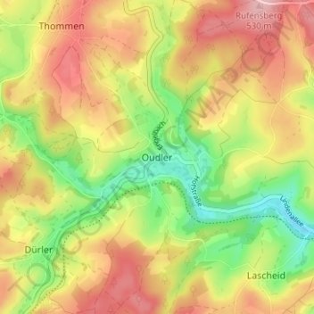
Name: Burg-Reuland topographic map, elevation, terrain.
Location: Oudler, Burg-Reuland, Liège, Wallonie, 4790, Belgique (50.18231 6.07337 50.22231 6.11337)
Average elevation: 456 m
Minimum elevation: 369 m
Maximum elevation: 538 m
Other topographic maps
Click on a map to view its topography, its elevation and its terrain.
Ulf
Belgique > Wallonie > Burg-Reuland
Ulf, Burg-Reuland, Verviers, Liège, Wallonie, 4790, Belgique
Average elevation: 449 m