
Abbotsbury topographic map
Interactive map
Click on the map to display elevation.
About this map
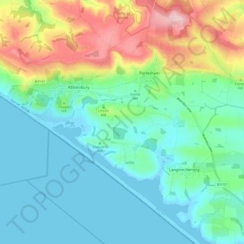
Name: Abbotsbury topographic map, elevation, terrain.
Location: Abbotsbury, Dorset, England, United Kingdom (50.63017 -2.65268 50.68088 -2.53482)
Average elevation: 65 m
Minimum elevation: -3 m
Maximum elevation: 238 m
Other topographic maps
Click on a map to view its topography, its elevation and its terrain.