
Milne Land topographic map
Interactive map
Click on the map to display elevation.
About this map
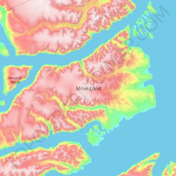
Name: Milne Land topographic map, elevation, terrain.
Location: Milne Land, Greenland (70.41369 -28.06595 71.08568 -25.26061)
Average elevation: 687 m
Minimum elevation: -2 m
Maximum elevation: 2,195 m
Other topographic maps
Click on a map to view its topography, its elevation and its terrain.