Geolocate

Lower Dicker topographic map

Click on the map to display elevation.

About this map

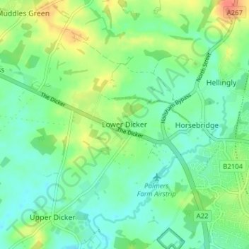
Name: Lower Dicker topographic map, elevation, terrain.

Location: Lower Dicker, Wealden District, East Sussex, England, BN27 4BD, United Kingdom (50.86159 0.20127 50.90159 0.24127)

Average elevation: 25 m

Minimum elevation: 9 m

Maximum elevation: 54 m

Other topographic maps

Click on a map to view its topography, its elevation and its terrain.

Ripe

United Kingdom > England > East Sussex > Wealden District

Average elevation: 15 m

Gear up for your next adventure:

🧼Biodegradable Outdoor Soap - Clean gear and yourself without harming the local ecosystem
🧊Insulated Stainless Steel Flasks - Keep water cold for 24 hours in the heat or coffee hot in the cold
🔌Fast Charging Adapters - Quickly top up all your gear before heading back into the field
🔋Solar Power Banks - Solar chargers for outdoors
🧭Compass - Navigation compasses for outdoor exploration

As an Amazon Associate, this site earns from qualifying purchases at no extra cost to you.