
Eft-Hellendorf topographic map
Interactive map
Click on the map to display elevation.
About this map
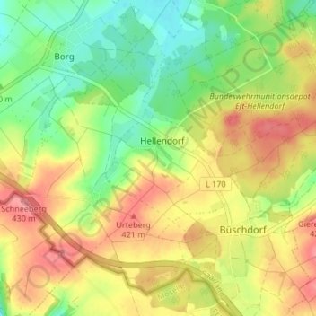
Name: Eft-Hellendorf topographic map, elevation, terrain.
Location: Eft-Hellendorf, Perl, Landkreis Merzig-Wadern, Sarre, Allemagne (49.46289 6.42958 49.50058 6.49640)
Average elevation: 388 m
Minimum elevation: 348 m
Maximum elevation: 430 m
Other topographic maps
Click on a map to view its topography, its elevation and its terrain.