
Leuk topographic map
Interactive map
Click on the map to display elevation.
About this map
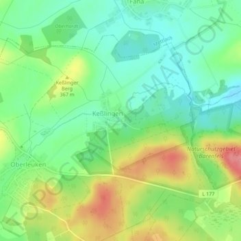
Name: Leuk topographic map, elevation, terrain.
Location: Leuk, Perl, Landkreis Merzig-Wadern, Sarre, Allemagne (49.51244 6.48416 49.51249 6.48433)
Average elevation: 355 m
Minimum elevation: 322 m
Maximum elevation: 409 m
Other topographic maps
Click on a map to view its topography, its elevation and its terrain.
Eft-Hellendorf
Eft-Hellendorf, Perl, Landkreis Merzig-Wadern, Sarre, Allemagne
Average elevation: 388 m