Geolocate

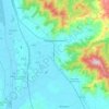
Borgo alla Collina topographic map

Click on the map to display elevation.

About this map

Name: Borgo alla Collina topographic map, elevation, terrain.

Location: Borgo alla Collina, Castel San Niccolò, Arezzo, Tuscany, 52018, Italy (43.72941 11.70522 43.76941 11.74522)

Average elevation: 436 m

Minimum elevation: 340 m

Maximum elevation: 721 m

Other topographic maps

Click on a map to view its topography, its elevation and its terrain.
Castiglion Fiorentino

Italy > Tuscany > Arezzo

Average elevation: 374 m

Loro Ciuffenna

Italy > Tuscany > Arezzo

Average elevation: 602 m

Lucignano

Italy > Tuscany > Arezzo > Lucignano

Average elevation: 301 m

Cavriglia

Italy > Tuscany > Arezzo

Average elevation: 314 m

Pergine Valdarno

Italy > Tuscany > Arezzo

Average elevation: 313 m

Pratovecchio Stia

Italy > Tuscany > Arezzo

Average elevation: 856 m

Toppole

Italy > Tuscany > Arezzo > Anghiari

Average elevation: 509 m

Chitignano

Italy > Tuscany > Arezzo

Average elevation: 655 m

Gear up for your next adventure:

🔋Rechargeable Batteries - Eco-friendly power for high-drain GPS units and flashlights
🥤Outdoor Water Bottles - Reusable bottles for outdoor activities
🕶️Polarized Outdoor Sunglasses - Reduce glare from rocks and water for better visual navigation
🪢550 Survival Paracord - Versatile cordage for gear repair and emergency lashing
🔪Outdoor Multi-tools - Versatile tools for gear repair and survival tasks in the wilderness

As an Amazon Associate, this site earns from qualifying purchases at no extra cost to you.