Geolocate

Bull Run topographic map

Click on the map to display elevation.

About this map

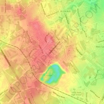
Name: Bull Run topographic map, elevation, terrain.

Location: Bull Run, Prince William County, Virginia, United States (38.76165 -77.53713 38.79798 -77.50148)

Average elevation: 81 m

Minimum elevation: 30 m

Maximum elevation: 104 m

Gear up for your next adventure:

🥾Hiking Shoes - Lightweight hiking shoes for day hikes
📍Handheld GPS - GPS devices for hiking and navigation
🧥Insulated Down Jackets - High warmth-to-weight ratio for cold nights in the high country
🧥Thermal Emergency Blankets - Compact Mylar blankets to prevent hypothermia if stranded overnight
🔥Windproof Plasma Lighters - USB rechargeable lighters that work in high-altitude winds

As an Amazon Associate, this site earns from qualifying purchases at no extra cost to you.