Geolocate

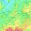
Fifield topographic map

Click on the map to display elevation.

About this map
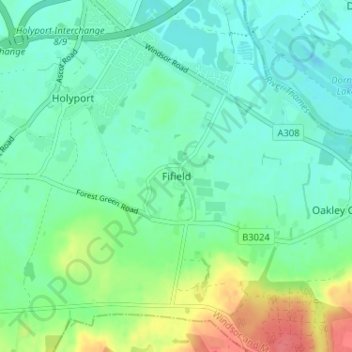
Name: Fifield topographic map, elevation, terrain.

Location: Fifield, Bray, Berkshire, England, SL6 2PB, United Kingdom (51.46346 -0.71505 51.50346 -0.67505)

Average elevation: 33 m

Minimum elevation: 17 m

Maximum elevation: 74 m

Other topographic maps

Click on a map to view its topography, its elevation and its terrain.

Bucklebury

United Kingdom > England > Berkshire

Average elevation: 99 m

Bracknell

United Kingdom > England > Berkshire

Average elevation: 80 m

Reading

United Kingdom > England > Berkshire > Reading

Average elevation: 58 m

Thatcham

United Kingdom > England > Berkshire

Average elevation: 94 m

Midgham

United Kingdom > England > Berkshire > West Berkshire

Average elevation: 90 m

Sonning

United Kingdom > England > Berkshire

Average elevation: 45 m

River Loddon

United Kingdom > England > Berkshire > Winnersh

Average elevation: 68 m

Gear up for your next adventure:

🧯Animal Deterrent Spray - Safety spray for wildlife
🎧Bluetooth Outdoor Earbuds - Listen to navigation cues or podcasts during long solo treks
🧤Thermal Hiking Gloves - Keep your hands warm and functional during high-altitude winter treks
🧦Hiking Socks - Comfortable socks for long hikes
🧼Biodegradable Outdoor Soap - Clean gear and yourself without harming the local ecosystem

As an Amazon Associate, this site earns from qualifying purchases at no extra cost to you.