Geolocate

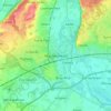
Sonning topographic map

Click on the map to display elevation.

About this map

Name: Sonning topographic map, elevation, terrain.

Location: Sonning, Berkshire, England, United Kingdom (51.45950 -0.92963 51.48704 -0.88337)

Average elevation: 45 m

Minimum elevation: 31 m

Maximum elevation: 79 m

Other topographic maps

Click on a map to view its topography, its elevation and its terrain.

Slough

United Kingdom > England > Berkshire

Average elevation: 34 m

Maidenhead

United Kingdom > England > Berkshire

Average elevation: 41 m

Ascot

United Kingdom > England > Berkshire

Average elevation: 72 m

Ascot

United Kingdom > England > Berkshire

Average elevation: 72 m

Arborfield

United Kingdom > England > Berkshire

Average elevation: 57 m

Reading

United Kingdom > England > Berkshire > Reading

Average elevation: 58 m

Fifield

United Kingdom > England > Berkshire

Average elevation: 33 m

Gear up for your next adventure:

🪢Paracord - Multi-purpose survival cord
🧊Insulated Cooler Bags - Keep food fresh for day trips to remote geographic sites
🏫Topographic World Globes - 3D physical relief globes to understand global geography
🧦Merino Wool Hiking Socks - Moisture-wicking socks to prevent blisters during long topographic surveys
🥾Heavy Duty Hiking Boots - Ankle-supporting boots for carrying heavy packs on steep contours

As an Amazon Associate, this site earns from qualifying purchases at no extra cost to you.