
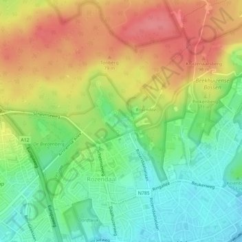
Kasteel Rosendael topographic map
Interactive map
Click on the map to display elevation.
About this map
Name: Kasteel Rosendael topographic map, elevation, terrain.
Average elevation: 55 m
Minimum elevation: 17 m
Maximum elevation: 98 m
Other topographic maps
Click on a map to view its topography, its elevation and its terrain.
Imbosch
Nederland > Gelderland > Rozendaal
Imbosch, Rozendaal, Gelderland, Nederland, 6891 DZ, Nederland
Average elevation: 71 m
Imbosch
Nederland > Gelderland > Rozendaal
Imbosch, Rozendaal, Gelderland, Nederland, 6961 LJ, Nederland
Average elevation: 64 m