
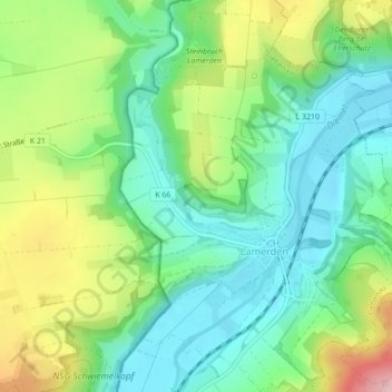
FFH-Gebiet Kalkmagerrasen topographic map
Interactive map
Click on the map to display elevation.
About this map
Name: FFH-Gebiet Kalkmagerrasen topographic map, elevation, terrain.
Average elevation: 199 m
Minimum elevation: 129 m
Maximum elevation: 338 m
Other topographic maps
Click on a map to view its topography, its elevation and its terrain.
Lamerden
Deutschland > Hessen > Landkreis Kassel > Lamerden
Lamerden, Liebenau, Landkreis Kassel, Hessen, Deutschland
Average elevation: 215 m