Geolocate

Little Hallingbury topographic map

Click on the map to display elevation.

About this map

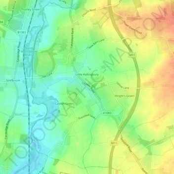
Name: Little Hallingbury topographic map, elevation, terrain.

Location: Little Hallingbury, Uttlesford, Essex, England, United Kingdom (51.81930 0.16088 51.85074 0.21299)

Average elevation: 69 m

Minimum elevation: 47 m

Maximum elevation: 95 m

👉 Easily get elevation data in JSON, GeoTIFF and KML formats using Elevation API
Thank you for supporting this site ❤️
Make a donation

Gear up for your next adventure:

As an Amazon Associate, this site earns from qualifying purchases at no extra cost to you.

Other topographic maps

Click on a map to view its topography, its elevation and its terrain.

Saffron Walden

United Kingdom > England > Essex > Uttlesford

Average elevation: 88 m

Howlett End

United Kingdom > England > Essex > Uttlesford

Average elevation: 105 m

Start Hill

United Kingdom > England > Essex > Uttlesford > Birchanger

Average elevation: 90 m

Langley Upper Green

United Kingdom > England > Essex > Uttlesford

Average elevation: 126 m

Little Walden

United Kingdom > England > Essex > Uttlesford

Average elevation: 94 m

Rickling Green

United Kingdom > England > Essex > Uttlesford > Quendon

Average elevation: 95 m

Coles Green

United Kingdom > England > Essex > Uttlesford > Berden > Little London

Average elevation: 100 m

Oxen End

United Kingdom > England > Essex > Uttlesford

Average elevation: 89 m

Church End

United Kingdom > England > Essex > Uttlesford > Great Dunmow

Average elevation: 78 m

Rowney Corner

United Kingdom > England > Essex > Uttlesford

Average elevation: 110 m

Burton End

United Kingdom > England > Essex > Uttlesford

Average elevation: 95 m

Bishops Green

United Kingdom > England > Essex > Uttlesford

Average elevation: 83 m

Hatfield Heath

United Kingdom > England > Essex > Uttlesford

Average elevation: 74 m

Gaunt's End

United Kingdom > England > Essex > Uttlesford > Molehill Green

Average elevation: 103 m

Saffron Walden

United Kingdom > England > Essex > Uttlesford

Average elevation: 88 m

Chrishall Common

United Kingdom > England > Essex > Uttlesford

Average elevation: 132 m

High Roding

United Kingdom > England > Essex > Uttlesford

Average elevation: 79 m

Tye Green

United Kingdom > England > Essex > Uttlesford

Average elevation: 99 m

Gear up for your next adventure:

🧼Biodegradable Outdoor Soap - Clean gear and yourself without harming the local ecosystem
🔋Solar Power Banks - Solar chargers for outdoors
🖼️Scratch-off Australia Map - Track the regions and peaks you have explored geographically
📡Weather Radios - Emergency weather radios
🏫Topographic World Globes - 3D physical relief globes to understand global geography

As an Amazon Associate, this site earns from qualifying purchases at no extra cost to you.