Geolocate

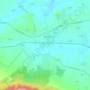
Quicks Mill topographic map

Click on the map to display elevation.

About this map

Name: Quicks Mill topographic map, elevation, terrain.

Location: Quicks Mill, Augusta County, Virginia, 24482, United States (38.19235 -79.04920 38.23235 -79.00920)

Average elevation: 438 m

Minimum elevation: 366 m

Maximum elevation: 507 m

Other topographic maps

Click on a map to view its topography, its elevation and its terrain.

Greenville

United States > Virginia > Augusta County > Greenville

Average elevation: 508 m

Crimora

United States > Virginia > Augusta County > Crimora

Average elevation: 409 m

Lyndhurst

United States > Virginia > Augusta County > Lyndhurst

Average elevation: 446 m

Deerfield

United States > Virginia > Augusta County

Average elevation: 585 m

Stuarts Draft

United States > Virginia > Augusta County

Stuarts Draft includes several natural and man-made ponds. Lake Wilda is Green Pond is a naturally occurring high-elevation pond on the Big Levels Ridge. It is five acres in size during the wet season. The Virginia Commission of Game and Inland Fisheries constructed the Maple Flats Ponds in the late 1950s to…

Average elevation: 457 m

Lyndhurst

United States > Virginia > Augusta County > Lyndhurst

Average elevation: 437 m

Gear up for your next adventure:

🔥Ferrocerium Rod Fire Starters - Reliable fire lighting in wet or windy conditions without matches
🩹Wilderness First Aid Kits - Comprehensive medical kits tailored for hiking and remote exploration
👕UPF 50+ Sun Shirts - Essential protection against the harsh Australian sun during field work
📖Australian Bush Survival Books - Local knowledge on finding water and surviving the outback
🛰️Handheld GPS Units - Rugged GPS devices for tracking coordinates and elevation in the Australian bush

As an Amazon Associate, this site earns from qualifying purchases at no extra cost to you.