
Lewisburg topographic map
Interactive map
Click on the map to display elevation.
About this map
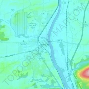
Name: Lewisburg topographic map, elevation, terrain.
Location: Lewisburg, Union County, Pennsylvania, 17837, United States (40.92453 -76.92476 41.00453 -76.84476)
Average elevation: 157 m
Minimum elevation: 126 m
Maximum elevation: 389 m
Other topographic maps
Click on a map to view its topography, its elevation and its terrain.
Union County
United States > Pennsylvania > Union County > Lewisburg
Union County, Lewisburg, Union County, Pennsylvania, United States
Average elevation: 143 m