
Kashatagh topographic map
Interactive map
Click on the map to display elevation.
About this map
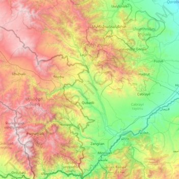
Name: Kashatagh topographic map, elevation, terrain.
Location: Kashatagh, République d'Artsakh, Azerbaïdjan (38.86717 45.88785 39.97695 46.92554)
Average elevation: 1,344 m
Minimum elevation: 80 m
Maximum elevation: 3,824 m
Other topographic maps
Click on a map to view its topography, its elevation and its terrain.
Zangilan
Azerbaïdjan > Kashatagh > Zangilan
Zangilan, Kashatagh, République d'Artsakh, Azerbaïdjan
Average elevation: 524 m