
Tulove Grede topographic map
Interactive map
Click on the map to display elevation.
About this map
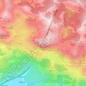
Name: Tulove Grede topographic map, elevation, terrain.
Location: Tulove Grede, Općina Jasenice, Zadar County, Croatia (44.26343 15.65558 44.26353 15.65568)
Average elevation: 852 m
Minimum elevation: 438 m
Maximum elevation: 1,108 m
Other topographic maps
Click on a map to view its topography, its elevation and its terrain.