
El Oued topographic map
Interactive map
Click on the map to display elevation.
About this map
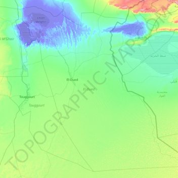
Name: El Oued topographic map, elevation, terrain.
Location: El Oued, RADP (32.00126 5.18272 34.51109 9.06531)
Average elevation: 138 m
Minimum elevation: -32 m
Maximum elevation: 1,288 m
Other topographic maps
Click on a map to view its topography, its elevation and its terrain.