Geolocate

Vintrie topographic map

Click on the map to display elevation.

About this map
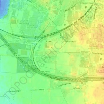
Name: Vintrie topographic map, elevation, terrain.

Location: Vintrie, Väster, Malmö, Malmö kommun, Skåne County, 218 45, Sweden (55.54686 12.93272 55.56219 12.98361)

Average elevation: 15 m

Minimum elevation: -49 m

Maximum elevation: 28 m

Other topographic maps

Click on a map to view its topography, its elevation and its terrain.

Jerusalem

Sweden > Skåne County > Malmo

Average elevation: 6 m

Bunkeflo

Sweden > Skåne County > Malmo

Average elevation: 14 m

Bunkeflo

Sweden > Skåne County > Malmo

Average elevation: 14 m

Arlöv

Sweden > Skåne County > Malmo

Average elevation: 8 m

Helge

Sweden > Skåne County > Malmo

Average elevation: 7 m

Gear up for your next adventure:

🛌Compact Down Sleeping Bags - Warmth without the bulk, ideal for backcountry camping
🔑Heavy Duty Carabiners - Secure gear to the outside of your pack for easy access
🎒Tactical Waist Packs - Quick access to your compass, phone, and snacks while walking
🧊Insulated Stainless Steel Flasks - Keep water cold for 24 hours in the heat or coffee hot in the cold
📖Australian Bush Survival Books - Local knowledge on finding water and surviving the outback

As an Amazon Associate, this site earns from qualifying purchases at no extra cost to you.