Geolocate

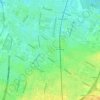
Jerusalem topographic map

Click on the map to display elevation.

About this map

Name: Jerusalem topographic map, elevation, terrain.

Location: Jerusalem, Old Town, Norr, Malmö, Malmö kommun, Skåne County, Sweden (55.60571 13.00848 55.60646 13.00987)

Average elevation: 6 m

Minimum elevation: -13 m

Maximum elevation: 15 m

Other topographic maps

Click on a map to view its topography, its elevation and its terrain.

Vintrie

Sweden > Skåne County > Malmo

Average elevation: 15 m

Bunkeflo

Sweden > Skåne County > Malmo

Average elevation: 14 m

Bunkeflo

Sweden > Skåne County > Malmo

Average elevation: 14 m

Arlöv

Sweden > Skåne County > Malmo

Average elevation: 8 m

Vintrie

Sweden > Skåne County > Malmo

Average elevation: 15 m

Ribersborg

Sweden > Skåne County > Malmo

Average elevation: 5 m

Augustenborg

Sweden > Skåne County > Malmo

Average elevation: 18 m

Kirsebergsstaden

Sweden > Skåne County > Malmo

Average elevation: 5 m

Gear up for your next adventure:

🧭Military Style Lensatic Compass - Durable sighting compasses for advanced land navigation and surveying
🦶Orthotic Hiking Insoles - Extra arch support for long-distance topographic treks
🐍Australian Snake Bite Kits - Specific pressure immobilization bandages for Australian venomous snakes
🧥Insulated Down Jackets - High warmth-to-weight ratio for cold nights in the high country
🛌Compact Down Sleeping Bags - Warmth without the bulk, ideal for backcountry camping

As an Amazon Associate, this site earns from qualifying purchases at no extra cost to you.