
Bayandun topographic map
Interactive map
Click on the map to display elevation.
About this map
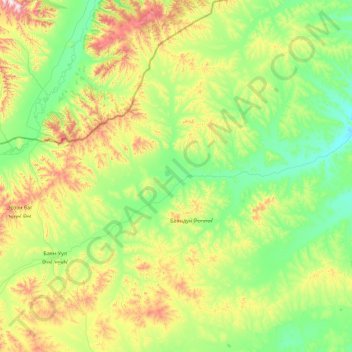
Name: Bayandun topographic map, elevation, terrain.
Location: Bayandun, Dornod, Mongolei (48.80280 112.76734 49.97923 114.04122)
Average elevation: 951 m
Minimum elevation: 724 m
Maximum elevation: 1,718 m
Other topographic maps
Click on a map to view its topography, its elevation and its terrain.
Tschoibalsan
Tschoibalsan, Kherlen, Dornod, Mongolei
Average elevation: 764 m