
Edenderry topographic map
Interactive map
Click on the map to display elevation.
About this map
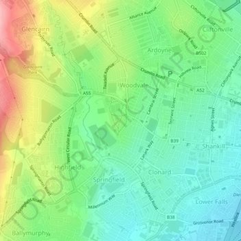
Name: Edenderry topographic map, elevation, terrain.
Average elevation: 50 m
Minimum elevation: 2 m
Maximum elevation: 138 m
Other topographic maps
Click on a map to view its topography, its elevation and its terrain.
Ballygomartin
United Kingdom > Northern Ireland > County Antrim > Belfast
Ballygomartin, Ligoniel, Belfast, County Antrim, Northern Ireland, United Kingdom
Average elevation: 258 m
Botanic Gardens
United Kingdom > Northern Ireland > County Antrim > Belfast
Botanic Gardens, Queen's Quarter, Belfast, County Antrim, Northern Ireland, United Kingdom
Average elevation: 15 m
Cavehill
United Kingdom > Northern Ireland > County Antrim > Belfast
Cavehill, Belfast, County Antrim, Northern Ireland, BT36 7PN, United Kingdom
Average elevation: 188 m
McArt's Fort
United Kingdom > Northern Ireland > County Antrim > Belfast
McArt's Fort, Ben Madigan Heights, Whitewell, Belfast, County Antrim, Northern Ireland, BT36 7RW, United Kingdom
Average elevation: 165 m