
Pola de Siero topographic map
Interactive map
Click on the map to display elevation.
About this map
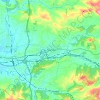
Name: Pola de Siero topographic map, elevation, terrain.
Location: Pola de Siero, Siero, Asturias, 33510, España (43.35141 -5.70084 43.43141 -5.62084)
Average elevation: 270 m
Minimum elevation: 173 m
Maximum elevation: 537 m
Other topographic maps
Click on a map to view its topography, its elevation and its terrain.