
阿荣旗 topographic map
Interactive map
Click on the map to display elevation.
About this map
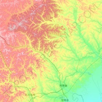
Name: 阿荣旗 topographic map, elevation, terrain.
Location: 阿荣旗, 呼伦贝尔市, 内蒙古自治区, 中国 (47.94868 122.04539 49.29202 124.26040)
Average elevation: 465 m
Minimum elevation: 161 m
Maximum elevation: 1,169 m
Other topographic maps
Click on a map to view its topography, its elevation and its terrain.