
Wimborne Minster topographic map
Interactive map
Click on the map to display elevation.
About this map
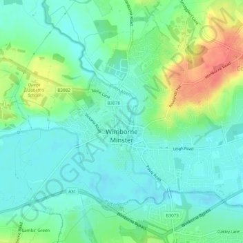
Name: Wimborne Minster topographic map, elevation, terrain.
Location: Wimborne Minster, Dorset, England, United Kingdom (50.78930 -2.00059 50.81324 -1.95232)
Average elevation: 31 m
Minimum elevation: 12 m
Maximum elevation: 76 m
Other topographic maps
Click on a map to view its topography, its elevation and its terrain.