
Grant topographic map
Click on the map to display elevation.
About this map
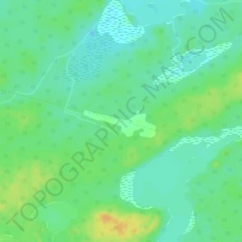
Name: Grant topographic map, elevation, terrain.
Average elevation: 308 m
Minimum elevation: 297 m
Maximum elevation: 325 m
Other topographic maps
Click on a map to view its topography, its elevation and its terrain.
Kabinakagami River
Canada > Ontario > Cochrane District > Unorganized North Cochrane
Average elevation: 250 m
Ptarmigan Lake
Canada > Ontario > Cochrane District > Unorganized North Cochrane
Average elevation: 225 m
Joseph Lake
Canada > Ontario > Cochrane District > Unorganized North Cochrane
Average elevation: 271 m
Moose Factory Island
Canada > Ontario > Cochrane District > Unorganized North Cochrane
Average elevation: 4 m
Wadsworth Lake
Canada > Ontario > Cochrane District > Unorganized North Cochrane
Average elevation: 323 m
Ghost River
Canada > Ontario > Cochrane District > Unorganized North Cochrane
Average elevation: 287 m
Ghost Lake;Pearce Creek
Canada > Ontario > Cochrane District > Unorganized North Cochrane
Average elevation: 213 m
Moose Factory Island
Canada > Ontario > Cochrane District > Unorganized North Cochrane
Average elevation: 4 m
Big Cedar Creek
Canada > Ontario > Cochrane District > Unorganized North Cochrane
Average elevation: 49 m