
Siresandra topographic map
Interactive map
Click on the map to display elevation.
About this map
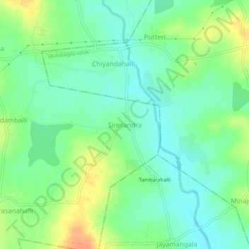
Name: Siresandra topographic map, elevation, terrain.
Location: Siresandra, Kolar taluk, Kolar district, Karnataka, India (13.06709 78.26077 13.10709 78.30077)
Average elevation: 795 m
Minimum elevation: 779 m
Maximum elevation: 821 m
Other topographic maps
Click on a map to view its topography, its elevation and its terrain.
Challahalli
India > Karnataka > Kolar taluk
Challahalli, Kolar taluk, Kolar District, Karnataka, 563102, India
Average elevation: 907 m
Bellur
India > Karnataka > Kolar taluk
Bellur, Kolar taluk, Kolar District, Karnataka, 563133, India
Average elevation: 874 m
Kolar
India > Karnataka > Kolar taluk
Kolar, Kolar taluk, Kolar District, Karnataka, 563101, India
Average elevation: 847 m