
Clifton Creek topographic map
Interactive map
Click on the map to display elevation.
About this map
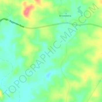
Name: Clifton Creek topographic map, elevation, terrain.
Location: Clifton Creek, Maryborough, Queensland, 4620, Australia (-25.63127 152.24596 -25.59581 152.26798)
Average elevation: 112 m
Minimum elevation: 86 m
Maximum elevation: 156 m
Queensland trails, hiking, mountain biking, running and outdoor activities
Other topographic maps
Click on a map to view its topography, its elevation and its terrain.