
Artedo topographic map
Interactive map
Click on the map to display elevation.
About this map
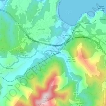
Name: Artedo topographic map, elevation, terrain.
Location: Artedo, Cudillero, Asturias, 33155, España (43.53231 -6.21467 43.57231 -6.17467)
Average elevation: 150 m
Minimum elevation: 0 m
Maximum elevation: 523 m
Other topographic maps
Click on a map to view its topography, its elevation and its terrain.