
Katakekile topographic map
Interactive map
Click on the map to display elevation.
About this map
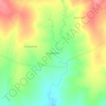
Name: Katakekile topographic map, elevation, terrain.
Location: Katakekile, Moroto, Northern Region, Uganda (2.36333 34.81333 2.40333 34.85333)
Average elevation: 1,475 m
Minimum elevation: 1,432 m
Maximum elevation: 1,520 m
Other topographic maps
Click on a map to view its topography, its elevation and its terrain.
South Karamoja Hunting Area
South Karamoja Hunting Area, Moroto, Northern Region, Uganda
Average elevation: 1,385 m