Geolocate

Alhambra topographic map

Click on the map to display elevation.

About this map

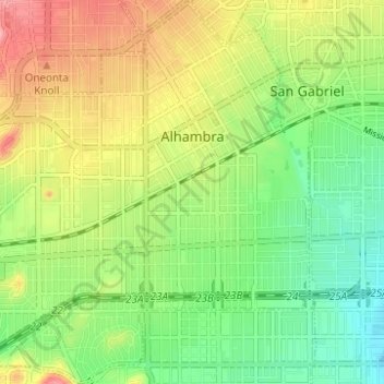
Name: Alhambra topographic map, elevation, terrain.

Location: Alhambra, Los Angeles County, California, United States (34.05994 -118.16484 34.11115 -118.10778)

Average elevation: 139 m

Minimum elevation: 89 m

Maximum elevation: 206 m

Other topographic maps

Click on a map to view its topography, its elevation and its terrain.

Mount Lewis

United States > California > Los Angeles County

Average elevation: 2,155 m

Gear up for your next adventure:

🔋Solar Power Banks - Solar chargers for outdoors
🧯Animal Deterrent Spray - Safety spray for wildlife
🔋Rechargeable Batteries - Eco-friendly power for high-drain GPS units and flashlights
Lightweight Tents - Compact tents for backpacking
💧Personal Water Filters - Drink safely from streams and lakes identified on your map

As an Amazon Associate, this site earns from qualifying purchases at no extra cost to you.