
Dakota Dunes topographic map
Interactive map
Click on the map to display elevation.
About this map
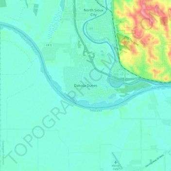
Name: Dakota Dunes topographic map, elevation, terrain.
Average elevation: 341 m
Minimum elevation: 322 m
Maximum elevation: 422 m
Other topographic maps
Click on a map to view its topography, its elevation and its terrain.
Beresford
United States > South Dakota > Union County
Beresford, Union County, South Dakota, United States
Average elevation: 456 m