
Gemeinde Schwarzach topographic map
Interactive map
Click on the map to display elevation.
About this map
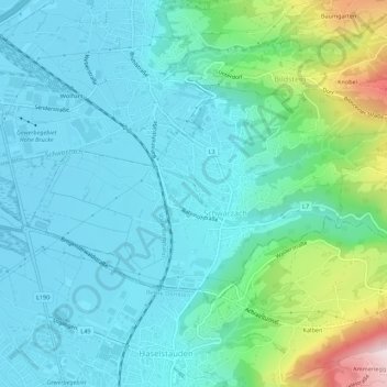
Name: Gemeinde Schwarzach topographic map, elevation, terrain.
Location: Gemeinde Schwarzach, Bezirk Bregenz, Vorarlberg, 6858, Austria (47.43647 9.73572 47.45743 9.79074)
Average elevation: 507 m
Minimum elevation: 403 m
Maximum elevation: 932 m
Other topographic maps
Click on a map to view its topography, its elevation and its terrain.
Gemeinde Sibratsgfäll
Austria > Vorarlberg > Bezirk Bregenz
Gemeinde Sibratsgfäll, Bezirk Bregenz, Vorarlberg, Austria
Average elevation: 1,245 m