
Samarai District topographic map
Interactive map
Click on the map to display elevation.
About this map
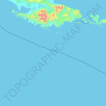
Name: Samarai District topographic map, elevation, terrain.
Location: Samarai District, Papua New Guinea (-11.64000 149.69333 -10.36000 150.97333)
Average elevation: 22 m
Minimum elevation: 0 m
Maximum elevation: 1,291 m
Other topographic maps
Click on a map to view its topography, its elevation and its terrain.
Laloki River
Papua New Guinea > National Capital District > National Capital District > Port Moresby
Average elevation: 38 m
New Britain
The island is part of two ecoregions. The New Britain–New Ireland lowland rain forests extend from sea level to 1,000 metres (3,300 ft) elevation. The New Britain–New Ireland montane rain forests cover the mountains of New Britain above 1,000 metres (3,300 ft) elevation.
Average elevation: 77 m
New Guinea
A spine of east–west mountains, the New Guinea Highlands, dominates the geography of New Guinea, stretching over 1,600 km (1,000 mi) across the island, with many mountains over 4,000 m (13,100 ft). The western half of the island contains the highest mountains in Oceania, with its highest point, Puncak Jaya,…
Average elevation: 101 m
Trobriand Islands
The Trobriands consist of four main islands: Kiriwina—the largest—and Kaileuna, Vakuta, and Kitava. Kiriwina is 43 kilometres (27 miles) long, and varies in width from 1 to 16 kilometres (0.62 to 9.94 mi). In the 1980s, there were around 60 villages on the island, containing around 12,000 people, while the…
Average elevation: 1 m
New Guinea
A spine of east–west mountains, the New Guinea Highlands, dominates the geography of New Guinea, stretching over 1,600 km (1,000 mi) across the island, with many mountains over 4,000 m (13,100 ft). The western half of the island contains the highest mountains in Oceania, with its highest point, Puncak Jaya,…
Average elevation: 101 m
Trobriand Islands
The Trobriands consist of four main islands, the largest being Kiriwina Island, and the others being Kaileuna, Vakuta and Kitava. Kiriwina is 43 kilometres (27 miles) long, and varies in width from 1 to 16 kilometres (0.62 to 9.94 mi). In the 1980s, there were around sixty villages on the island, containing…
Average elevation: 1 m
Jiwaka
"Jiwaka" is a portmanteau word combining the first two letters each from the word Jimi, Waghi and Kambia. Jimi, Waghi and Kambia denote the topographical landscape referencing the Valley (Waghi Valley) and the mountain ranges at the north (Jimi) and south (Kambia).
Average elevation: 1,564 m
New Guinea
A spine of east–west mountains, the New Guinea Highlands, dominates the geography of New Guinea, stretching over 1,600 km (1,000 mi) across the island, with many mountains over 4,000 m (13,100 ft). The western half of the island contains the highest mountains in Oceania, with its highest point, Puncak Jaya,…
Average elevation: 101 m
Border Southern Highlands - Western Highlands
Papua New Guinea > Western Highlands
Average elevation: 1,625 m
Admiralty Islands
Manus reaches an elevation of 700 m (2,300 ft) and is volcanic in origin and probably broke through the ocean's surface in the late Miocene, 8–10 million years ago. The substrate of the island is either directly volcanic or from uplifted coral limestone.
Average elevation: 5 m