
New Valley Governorate topographic map
Interactive map
Click on the map to display elevation.
About this map
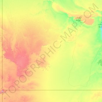
Name: New Valley Governorate topographic map, elevation, terrain.
Location: New Valley Governorate, Egypt (21.38028 25.12700 26.58028 30.32700)
Average elevation: 418 m
Minimum elevation: 34 m
Maximum elevation: 1,881 m
Other topographic maps
Click on a map to view its topography, its elevation and its terrain.
Sinai Peninsula
Sinai is one of the coldest provinces in Egypt because of its high altitudes and mountainous topographies. Winter temperatures in some of Sinai's cities and towns reach −16 °C (3 °F).
Average elevation: 457 m
Suez Canal
Despite the construction challenges that could have been the result of the alleged difference in sea levels, the idea of finding a shorter route to the east remained alive. In 1830, General Francis Chesney submitted a report to the British government that stated that there was no difference in elevation and…
Average elevation: 39 m