
Booyal topographic map
Interactive map
Click on the map to display elevation.
About this map
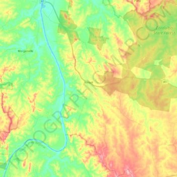
Name: Booyal topographic map, elevation, terrain.
Location: Booyal, Bundaberg Region, Queensland, 4671, Australia (-25.32119 151.98870 -25.12356 152.19583)
Average elevation: 89 m
Minimum elevation: 18 m
Maximum elevation: 189 m
Bundaberg Region trails, hiking, mountain biking, running and outdoor activities
Other topographic maps
Click on a map to view its topography, its elevation and its terrain.
Isis River
Australia > Queensland > Bundaberg Region > South Isis > Isis River
Average elevation: 43 m