
Cornubia topographic map
Interactive map
Click on the map to display elevation.
About this map
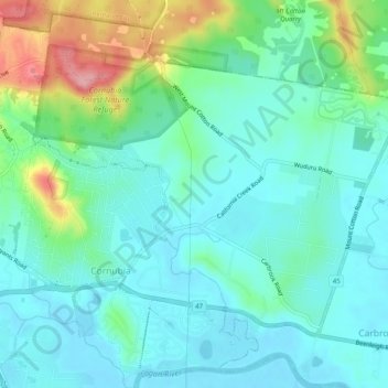
Name: Cornubia topographic map, elevation, terrain.
Location: Cornubia, Logan City, Queensland, 4130, Australia (-27.68072 153.18891 -27.63947 153.23894)
Average elevation: 36 m
Minimum elevation: 1 m
Maximum elevation: 145 m
Queensland trails, hiking, mountain biking, running and outdoor activities
Other topographic maps
Click on a map to view its topography, its elevation and its terrain.