
Bethania topographic map
Interactive map
Click on the map to display elevation.
About this map
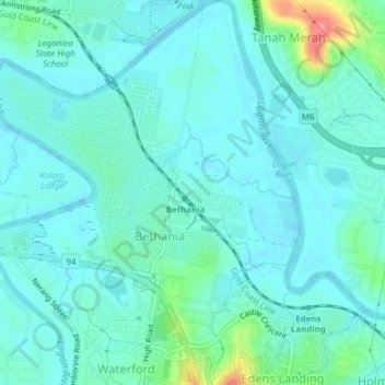
Name: Bethania topographic map, elevation, terrain.
Location: Bethania, Logan City, Queensland, 4205, Australia (-27.70499 153.13970 -27.67103 153.17011)
Average elevation: 15 m
Minimum elevation: -2 m
Maximum elevation: 83 m
Queensland trails, hiking, mountain biking, running and outdoor activities
Other topographic maps
Click on a map to view its topography, its elevation and its terrain.