
Zone 2 topographic map
Interactive map
Click on the map to display elevation.
About this map
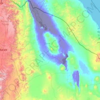
Name: Zone 2 topographic map, elevation, terrain.
Location: Zone 2, Afar Region, 1212, Ethiopia (12.42213 39.66199 14.54917 41.87671)
Average elevation: 637 m
Minimum elevation: -127 m
Maximum elevation: 3,932 m
Other topographic maps
Click on a map to view its topography, its elevation and its terrain.
Mount Langudi
Mount Langudi, Zone 3, Afar Region, Ethiopia
Average elevation: 1,089 m
Hodale Terara
Hodale Terara, Zone 1, Afar Region, Ethiopia
Average elevation: 1,050 m
Monte Unduru
Monte Unduru, Zone 1, Afar Region, Ethiopia
Average elevation: 1,029 m
Kharale Uonz
Kharale Uonz, Zone 2, Afar Region, Ethiopia
Average elevation: -119 m