Geolocate

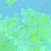
Norfolk topographic maps

Click on a map to view its topography, its elevation and its terrain.

Norfolk

United States > Virginia > Norfolk

Average elevation: 4 m

Suburban Acres

United States > Virginia > Norfolk

Average elevation: 5 m

Lake Taylor

United States > Virginia > Norfolk > Lake Terrace

Average elevation: 7 m

East Ocean View

United States > Virginia > Norfolk

Average elevation: 2 m

Pinewell

United States > Virginia > Norfolk

Average elevation: 3 m

Ballentine Place

United States > Virginia > Norfolk

Average elevation: 6 m

Easton Place

United States > Virginia > Norfolk

Average elevation: 7 m

Oceanair

United States > Virginia > Norfolk

Average elevation: 4 m

Cottage Road Park

United States > Virginia > Norfolk

Average elevation: 5 m

Forest Park

United States > Virginia > Norfolk

Average elevation: 5 m

Broad Creek

United States > Virginia > Norfolk > River Oaks

Average elevation: 6 m

About this place

 •

Gear up for your next adventure:

🧥Down Jackets - Insulated jackets for cold weather
🎧Bluetooth Outdoor Earbuds - Listen to navigation cues or podcasts during long solo treks
⛺Ultralight Solo Tents - Compact shelters for multi-day topographic surveying expeditions
🧥Insulated Down Jackets - High warmth-to-weight ratio for cold nights in the high country
🏫Topographic World Globes - 3D physical relief globes to understand global geography

As an Amazon Associate, this site earns from qualifying purchases at no extra cost to you.